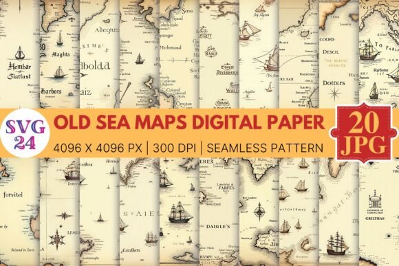
Old Sea Maps Digital Paper: A Practical Guide for Creators and Designers
In the evolving landscape of digital design, texture plays a pivotal role in grounding virtual creations with a sense of history and tactile reality. Among the myriad of background assets available to modern designers, Old Sea Maps Digital Paper has emerged as a versatile staple for projects requiring nautical authenticity, vintage charm, or cartographic elegance. Unlike generic parchment textures, these specialized digital papers capture the specific intricacies of maritime navigation history, offering depth that standard backgrounds often lack.
This guide explores the practical applications, technical considerations, and creative potential of using digitized antique sea charts. Whether you are a scrapbooker preserving family heritage, a graphic designer branding a seafood restaurant, or an educator creating immersive history lessons, understanding the nuances of this specific asset class will elevate the quality of your work.
Defining the Aesthetic: More Than Just Parchment
To utilize Old Sea Maps Digital Paper effectively, one must first understand what distinguishes it from general vintage paper. While standard aged paper provides a uniform yellowed background, sea map digital paper incorporates specific cartographic elements that tell a story. These textures typically feature high-resolution scans of rhumb lines, compass roses, coastal topography, and period-accurate typography.
The value lies in the intersection of texture and information. The visual noise of the scan—including fold lines, water stains, foxing (age spots), and ink bleed—provides an organic foundation. Simultaneously, the geographical lines offer structural guides for layout design. This duality allows the background to function as both a decorative element and a compositional tool, guiding the viewer’s eye across the canvas without overwhelming foreground content.
Key Visual Characteristics
- Rhumb Lines and Wind Roses: Radiating navigational lines that create natural focal points and dynamic movement within a static image.
- Coastal Detail: Intricate shoreline engravings that provide varying levels of visual density, useful for balancing negative space.
- Authentic Aging: Realistic degradation patterns including saltwater damage, creases from folding, and oxidation that synthetic filters cannot replicate.
- Historical Typography: Hand-lettered place names and archaic fonts that add typographic interest without requiring additional text layers.
Practical Applications Across Industries
The utility of Old Sea Maps Digital Paper extends far beyond pirate-themed party invitations. Its sophisticated aesthetic makes it suitable for professional, educational, and personal projects where credibility and atmosphere are paramount.
Branding and Packaging Design
For businesses in the maritime, travel, culinary, and heritage sectors, packaging is a storytelling medium. A craft brewery releasing a "Navigator IPA" or a tea company blending a "Trade Route Chai" can use these digital papers as label backgrounds or box wraps. The texture implies artisanal quality and historical continuity. When applied to physical products via print, the high-resolution details of the map interact beautifully with matte or uncoated paper stocks, enhancing the tactile experience for the consumer.
Digital Content and Web Design
Web designers and social media creators utilize these assets to break the sterility of flat design. In user interface design, subtle overlays of sea maps can add warmth to hero sections or serve as distinctive dividers between content blocks. For content creators on platforms like Pinterest or Instagram, using Old Sea Maps Digital Paper as a base for quote cards or informational carousels increases engagement by providing a visually rich context that stops the scroll.
Genealogy and Heritage Preservation
Perhaps the most poignant application is in family history. Digitizing ancestral records often results in stark, clinical documents. Placing these records against a relevant historical sea map contextualizes migration stories, naval service records, or port-of-entry documentation. It transforms a simple data point into a narrative journey, helping descendants visualize the physical realities of their ancestors' travels.
Evaluating Quality and Technical Suitability
Not all digital papers are created equal. When selecting Old Sea Maps Digital Paper for a project, professionals should evaluate assets based on technical specifications and licensing rather than aesthetics alone. A beautiful low-resolution image is useless for print, while a high-resolution file may be overkill for web thumbnails.
Resolution and File Integrity
For print projects, always verify that the file meets the 300 DPI (dots per inch) standard at the intended print size. Many digital papers are sold as 12x12 inch files optimized for scrapbooking; these may pixelate when stretched to poster size. Look for files labeled as "seamless" if you intend to tile them across large surfaces. Additionally, check the color profile: RGB files are ideal for screens, while CMYK profiles are necessary for accurate color reproduction in commercial printing. Note that authentic antique maps often have muted, desaturated tones; ensure the file retains enough contrast to remain legible after printing.
Licensing and Commercial Use
This is a critical consideration for business owners. Just because a map depicts a 17th-century coastline does not mean the digital scan is public domain. Museums and archivists hold copyrights on their specific high-resolution restorations. Always review the End User License Agreement (EULA). Some licenses permit personal use only, while others allow for commercial end-products but prohibit reselling the digital paper itself as part of a kit. Clarifying these terms upfront prevents legal complications down the line.
Design Strategies for Effective Integration
Incorporating complex textures requires restraint. The goal is to enhance readability, not compete with it. Here are proven methods for working with Old Sea Maps Digital Paper:
- Utilize Blend Modes: Instead of placing text directly on top of busy map details, use layer blend modes like Multiply, Overlay, or Soft Light. This allows the texture to show through solid color blocks or photographs, integrating the background organically rather than having it sit behind the content as a separate layer.
- Create Contrast Zones: If the map is dense with coastlines and text, create a semi-transparent solid shape behind your primary message. This ensures accessibility and legibility while maintaining the vintage atmosphere at the edges.
- Color Grading: Antique maps often carry strong sepia or yellow casts that may clash with modern brand colors. Use hue/saturation adjustment layers to shift the map’s tone toward cooler blues, warmer browns, or even grayscale to match your project’s palette.
- Directional Flow: Pay attention to the orientation of the map. Rhumb lines and rivers naturally direct the eye. Align your text and focal points with these existing vectors to create a harmonious composition that feels intentional rather than accidental.
Limitations and Considerations
While highly effective, Old Sea Maps Digital Paper is not a universal solution. There are scenarios where its use may be counterproductive. In minimalist corporate branding or tech-focused interfaces, the ornate detail can appear cluttered or tonally dissonant. Furthermore, users must be mindful of geographical accuracy if the project is educational or location-specific. Using a map of the Caribbean for a project about Pacific exploration introduces factual errors that undermine credibility.
Additionally, accessibility should never be sacrificed for aesthetics. Text placed over textured backgrounds must maintain WCAG contrast ratios. The intricate lines of a sea map can reduce readability for users with visual impairments if not managed carefully. Always test your designs with contrast checkers and consider providing alternative text descriptions when using these images in web environments.
Making the Right Choice for Your Project
Ultimately, the decision to use Old Sea Maps Digital Paper should be driven by the narrative needs of the project. Ask yourself: Does this texture add meaning, or merely decoration? Is the historical era appropriate? Does the resolution support the final output format?
When selected thoughtfully, these digital assets bridge the gap between past and present, lending authority and beauty to contemporary design. They remind us that every digital canvas has the potential to carry the weight of history, transforming pixels into portals of exploration. By understanding both the artistic possibilities and technical requirements, creators can harness the enduring appeal of maritime cartography to produce work that resonates deeply with audiences across all mediums.